Not to be confused with Maps.
Release status: stable |
|
|---|---|
 |
|
| Implementation | Parser function, Tag |
| Description | Allows users to display maps and coordinate data using multiple mapping services. |
| Author(s) | Jeroen De Dauw and others |
| Maintainer(s) | Professional Wiki |
| Latest version | See RELEASE NOTES |
| MediaWiki | 1.35+ |
| PHP | 7.4+ |
| Database changes | No |
| Composer | mediawiki/maps |
| License | GNU General Public License 2.0 or later |
| Download | GitHub: README |
| Example | Maps examples |
|
Hooks used
|
|
| Public wikis using | 6,478 (Ranked 1st) |
Maps is a MediaWiki extension to visualize and work with geographical information.
Maps has been maintained since 2009, is installed on 1000+ wikis and is used by NASA. Note that the maps used on Wikimedia sites such as Wikipedia and Wikivoyage are generated by the Kartographer extension, not the Maps extension.
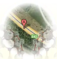
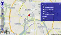
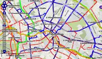
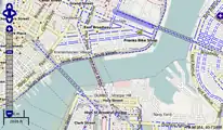
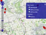
Screenshots
Some screenshots of inline maps created using the display_map parser hook:
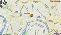
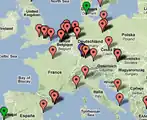
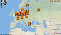
Semantic MediaWiki integration
Some screenshots of the integration with Semantic MediaWiki:
See also
- Semantic Result Formats - Various visualization formats for Extension:Semantic MediaWiki
- Extension:Kartographer - Allows displaying GeoJSON (so do recent versions of Maps)
- Extension:MultiMaps - Allows users to display maps and coordinate data using multiple mapping services
- Extension:Whats Nearby - Provides geolocation information to templates
This extension is included in the following wiki farms/hosts and/or packages:
|
This extension is professionally maintained by the Professional Wiki team.
This article is issued from Mediawiki. The text is licensed under Creative Commons - Attribution - Sharealike. Additional terms may apply for the media files.